Commissioned for a project with McDonalds and Coca Cola Australia to produce a piece of artwork for their Bondi Beach, (Sydney, Australia) McDonalds store, which was installed in January 2017.
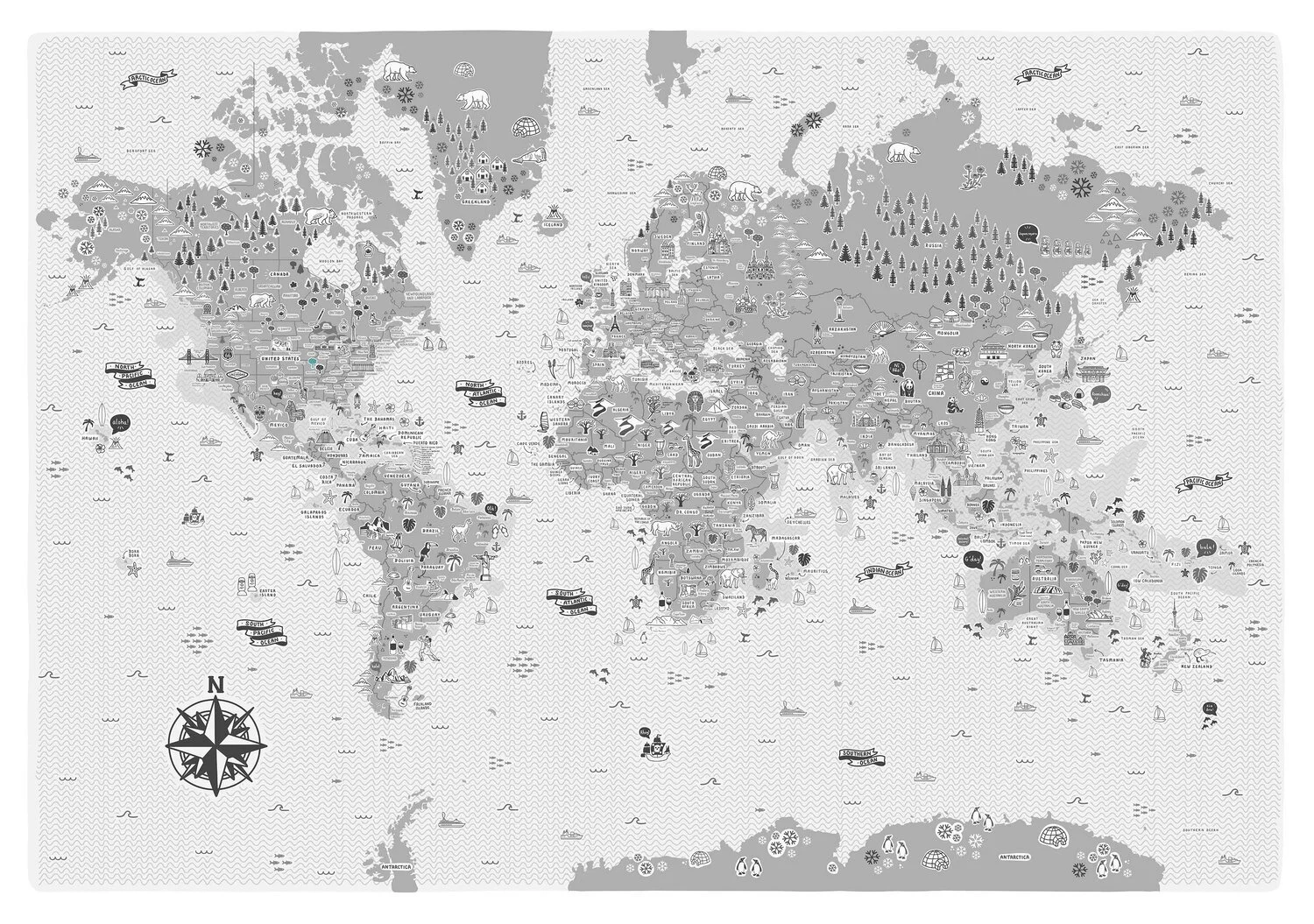
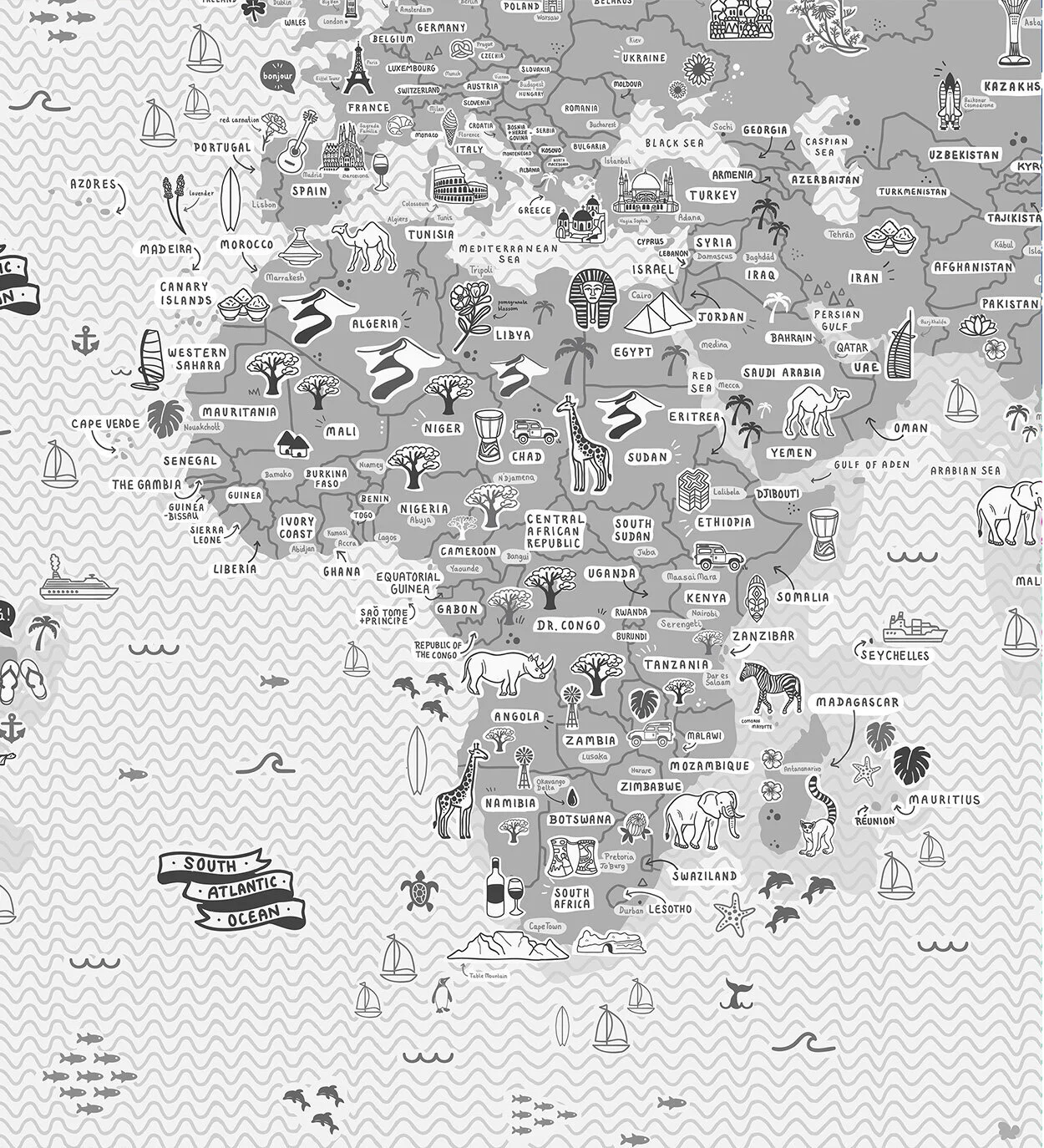
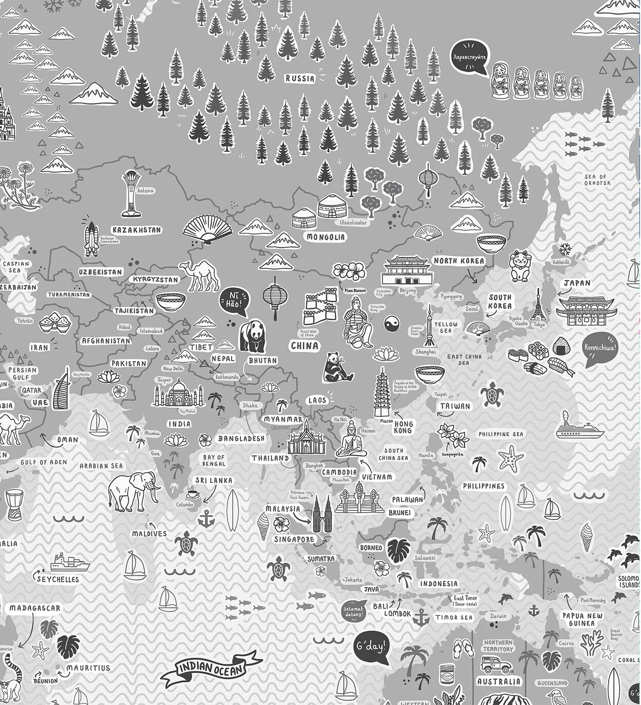
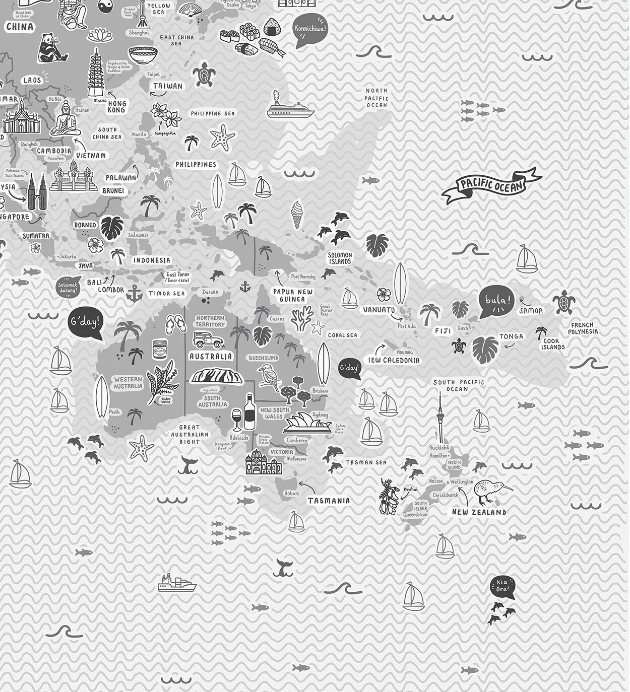
This is a striking, fun and incredibly detailed hand drawn, illustrated map of the world which took over 200+ hours to create. Whilst a stunning piece of art, it can also be used as a great reference map.
The artwork depicts all seven continents - Antartica, North America, Europe, South America, Africa, Asia and Oceania, plus capital cities and major towns. You’ll also enjoy the hundreds and hundreds of hand-drawn icons of some of the world’s most-visited and iconic attractions. Highlights include China’s Terracotta Army, Italy’s Colosseum, Spain’s Sagrada Familia, France’s Eiffel Tower, Australia’s Opera House, Brazil’s Christ the Redeemer, USA’s Golden Gate Bridge and Statue of Liberty, Easter Island’s Rapa Nui National Park, Mexico's Chichén Itzá and India’s Taj Mahal amongst hundreds and hundreds of others. You can also enjoy illustrated depictions of each region’s local flora, fauna and food.
The comprehensive nature of the piece means you will spot something new each time you look at it!
Illustrated map of Bondi Beach, (Sydney, Australia) highlighting the region's top and most popular attractions, restaurants and cafes.
Commission for GTI Tourism to create an illustrated map of Australia to promote their ongoing work with YHA Youth Hostels. This was featured in their marketing email newsletter.
Illustrated map of Paris, France map highlighting the region's top and most popular attractions, restaurants and cafes.
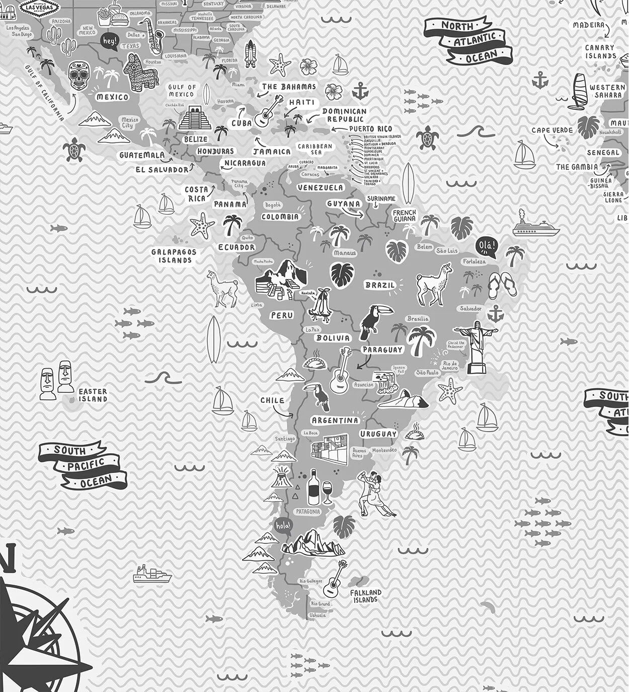
This is a striking, fun and incredibly detailed hand drawn, illustrated map of the world which took over 200+ hours to create. Whilst a stunning piece of art, it can also be used as a great reference map.
The artwork depicts all seven continents - Antartica, North America, Europe, South America, Africa, Asia and Oceania, plus capital cities and major towns. You’ll also enjoy the hundreds and hundreds of hand-drawn icons of some of the world’s most-visited and iconic attractions. Highlights include China’s Terracotta Army, Italy’s Colosseum, Spain’s Sagrada Familia, France’s Eiffel Tower, Australia’s Opera House, Brazil’s Christ the Redeemer, USA’s Golden Gate Bridge and Statue of Liberty, Easter Island’s Rapa Nui National Park, Mexico's Chichén Itzá and India’s Taj Mahal amongst hundreds and hundreds of others. You can also enjoy illustrated depictions of each region’s local flora, fauna and food.
The comprehensive nature of the piece means you will spot something new each time you look at it!
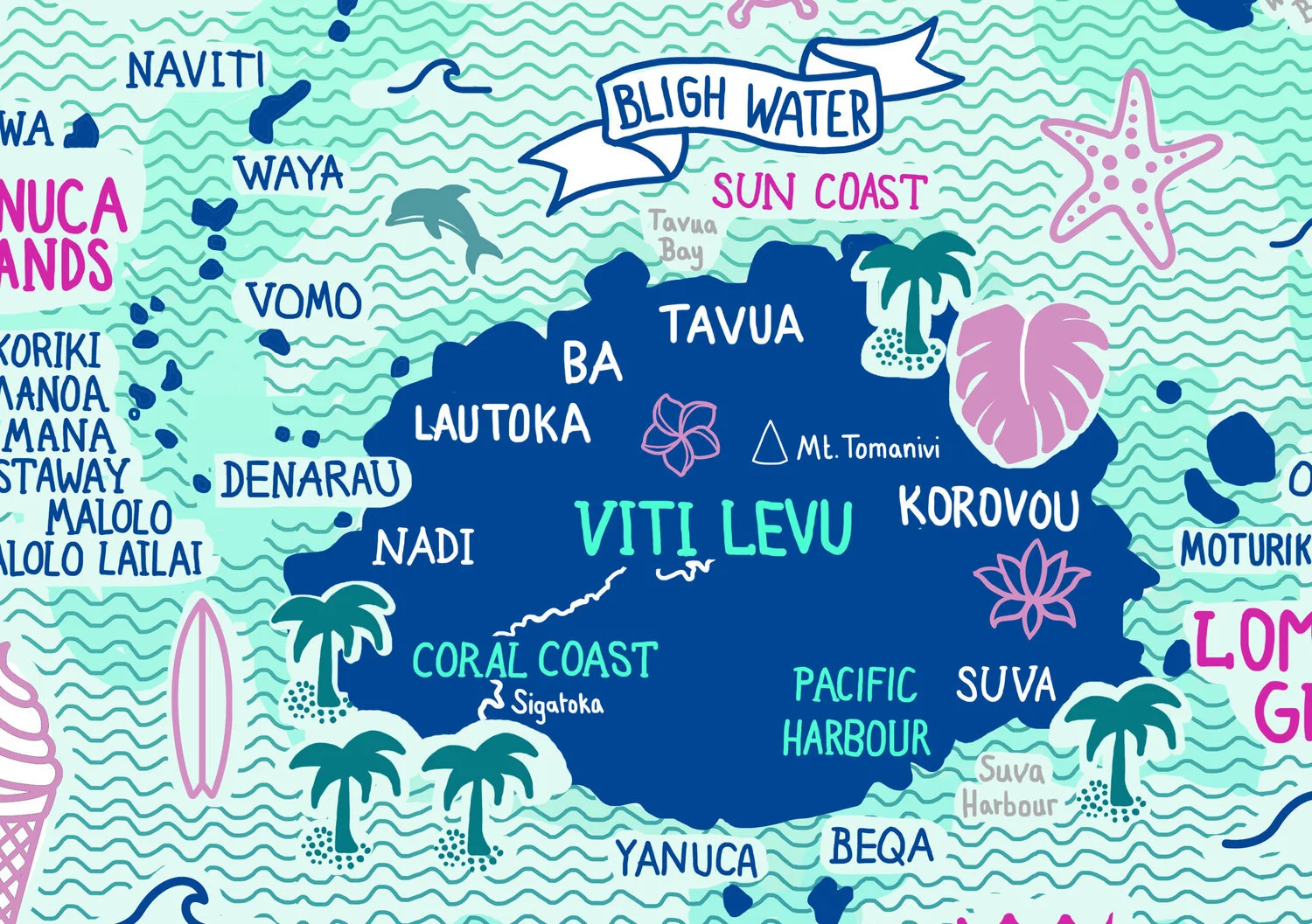
Illustrated map of Fiji map highlighting the 333 islands in this magnificent, tropical archipelago.
Commissioned by South African Tourism Board and National Geographic Magazine to create an illustrated map of South Africa for a travel supplement and online campaign.
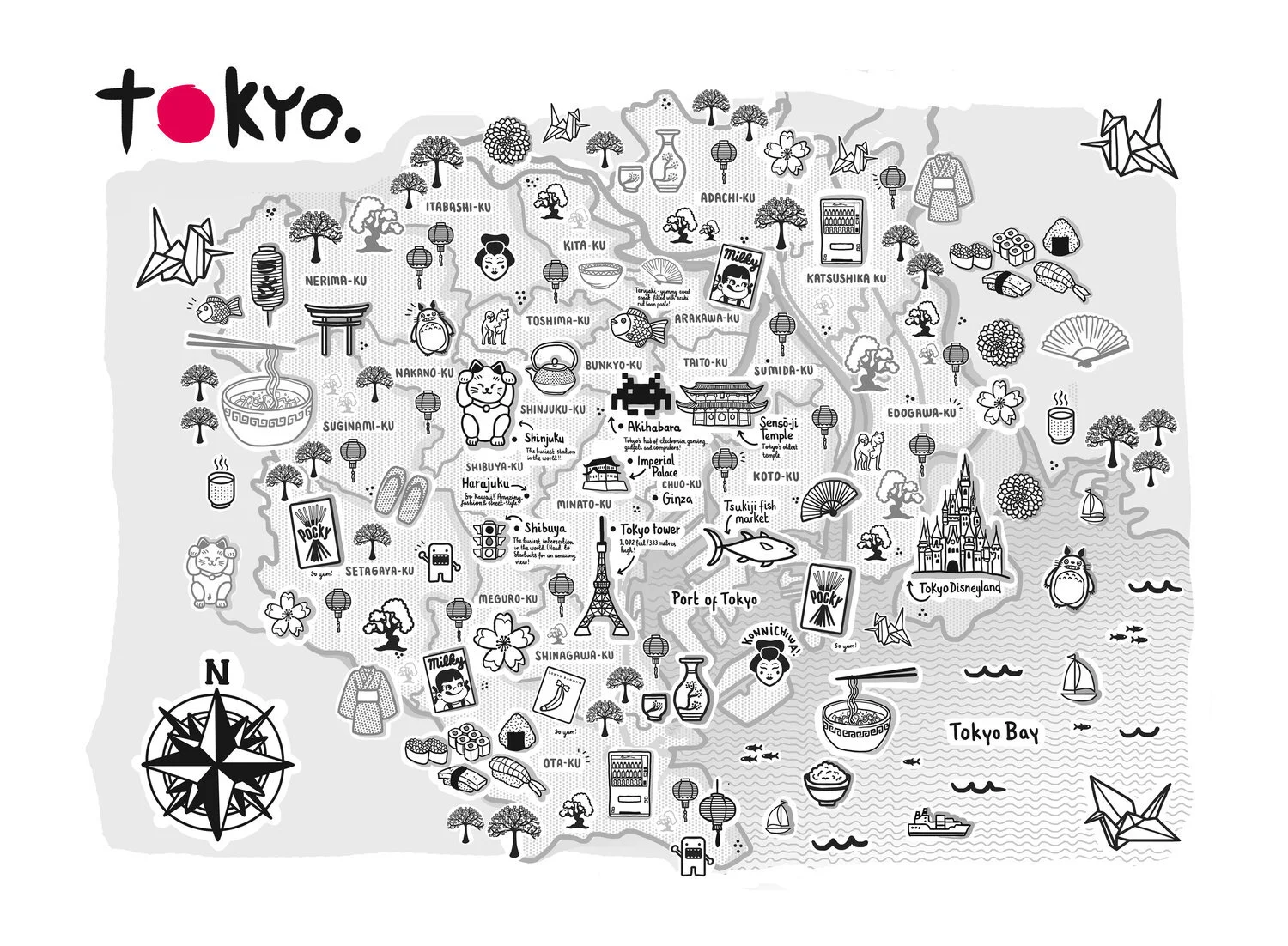
The Tokyo illustrated map is the perfect souvenir or momento for any resident, traveller or visitor.
Featuring many popular Tokyo hot-spots, alongside other Japanese memorabilia, icons and facts about the city metropolis.
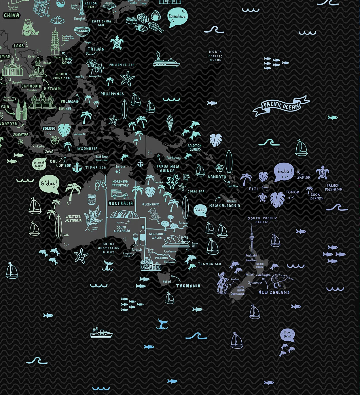
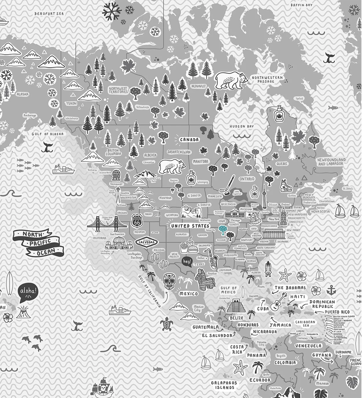
This is a striking, fun and incredibly detailed hand drawn, illustrated map of the world which took over 200+ hours to create. Whilst a stunning piece of art, it can also be used as a great reference map.
The artwork depicts all seven continents - Antartica, North America, Europe, South America, Africa, Asia and Oceania, plus capital cities and major towns. You’ll also enjoy the hundreds and hundreds of hand-drawn icons of some of the world’s most-visited and iconic attractions. Highlights include China’s Terracotta Army, Italy’s Colosseum, Spain’s Sagrada Familia, France’s Eiffel Tower, Australia’s Opera House, Brazil’s Christ the Redeemer, USA’s Golden Gate Bridge and Statue of Liberty, Easter Island’s Rapa Nui National Park, Mexico's Chichén Itzá and India’s Taj Mahal amongst hundreds and hundreds of others. You can also enjoy illustrated depictions of each region’s local flora, fauna and food.
The comprehensive nature of the piece means you will spot something new each time you look at it!
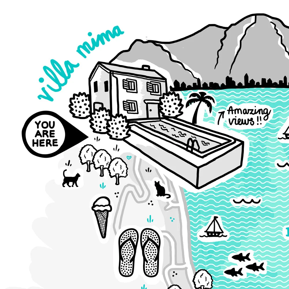
Illustrated map of Kotor, Montenegro highlighting the region's top and most popular attractions, restaurants and cafes.
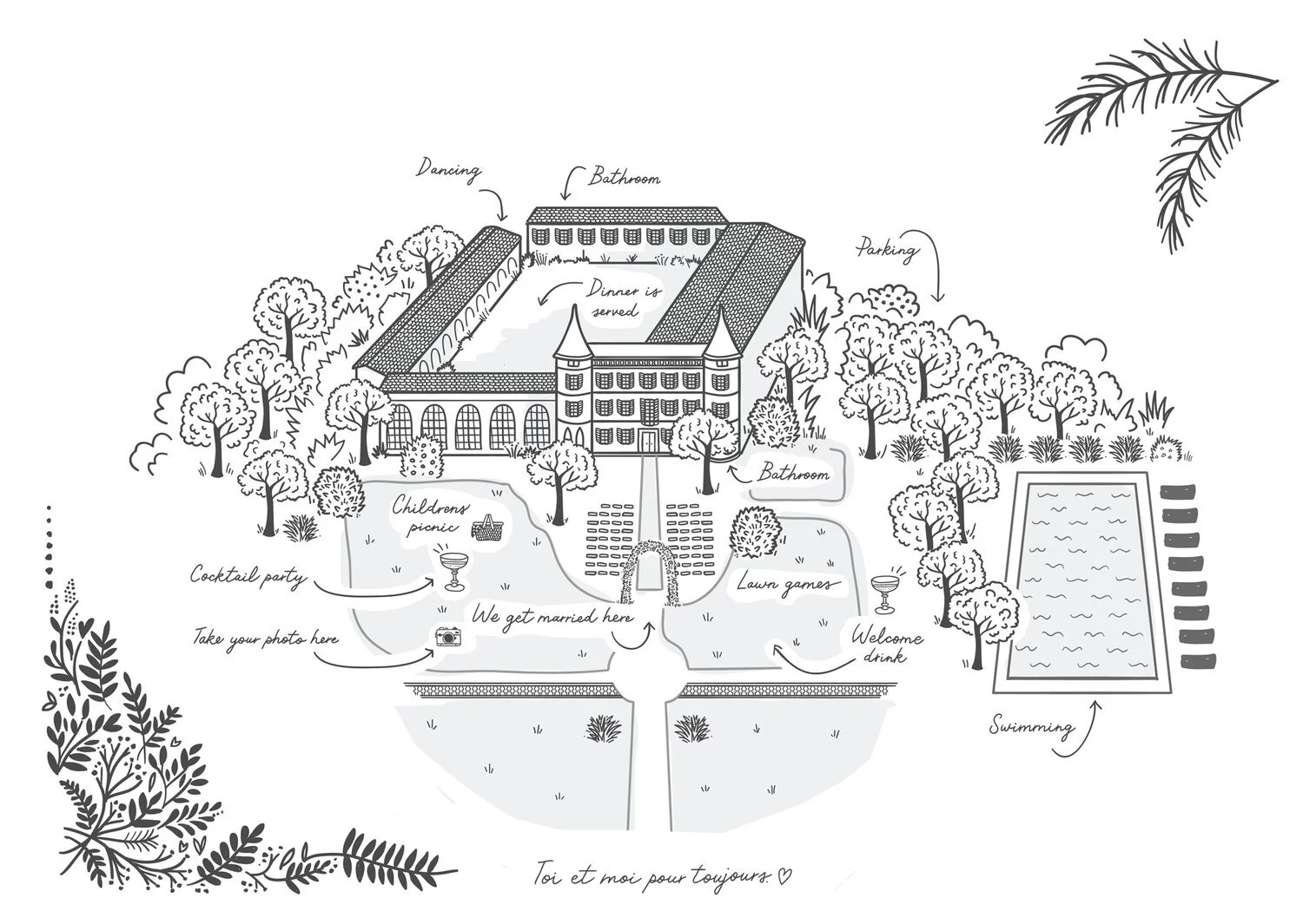
(This was a private commission.)
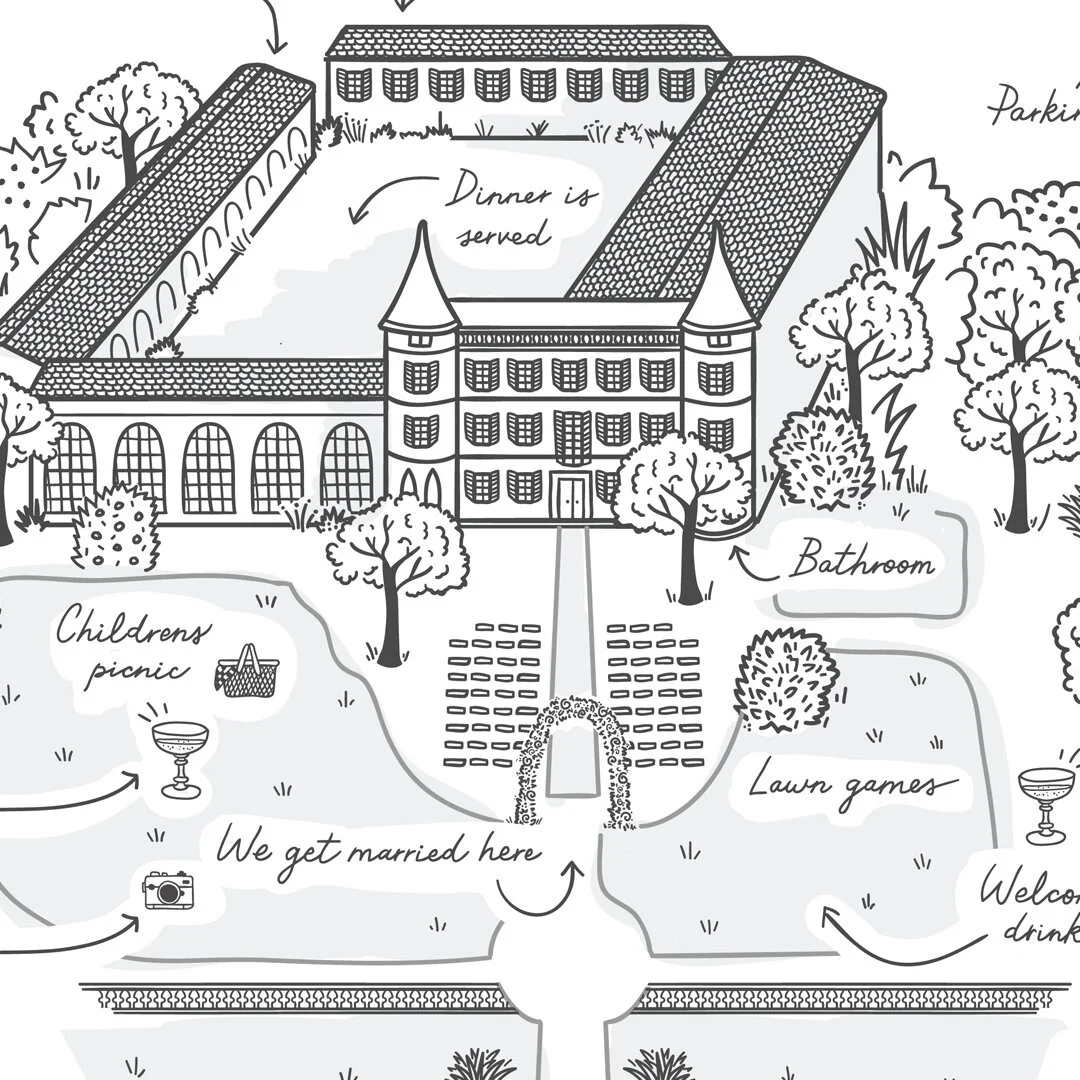
A private commission to create a wedding ‘map’ of Château de Robernier, the couple’s wedding venue, for use in the printed order-of-service during the day.
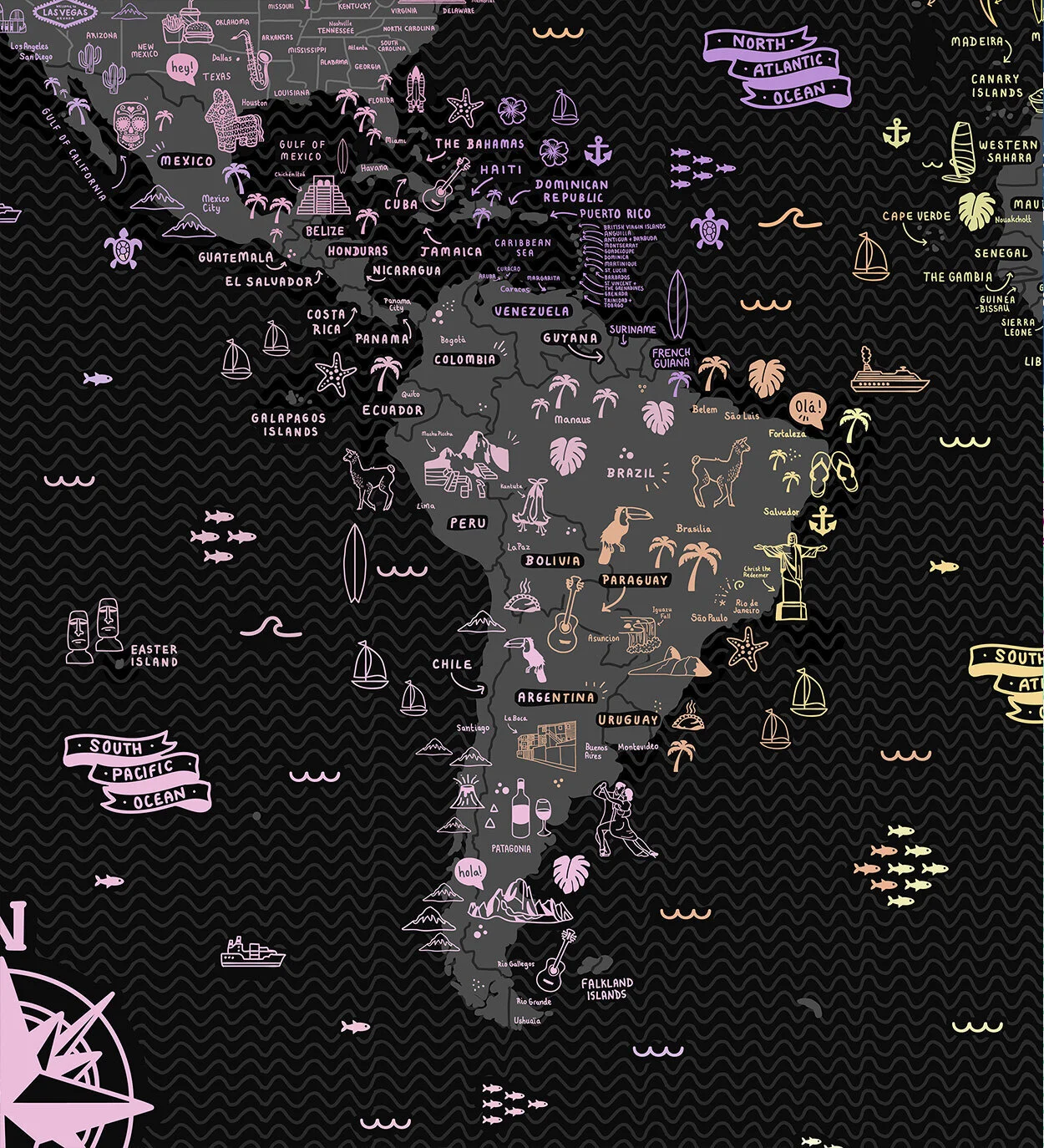
This is a striking, fun and incredibly detailed hand drawn, illustrated map of the world which took over 200+ hours to create. Whilst a stunning piece of art, it can also be used as a great reference map.
The artwork depicts all seven continents - Antartica, North America, Europe, South America, Africa, Asia and Oceania, plus capital cities and major towns. You’ll also enjoy the hundreds and hundreds of hand-drawn icons of some of the world’s most-visited and iconic attractions. Highlights include China’s Terracotta Army, Italy’s Colosseum, Spain’s Sagrada Familia, France’s Eiffel Tower, Australia’s Opera House, Brazil’s Christ the Redeemer, USA’s Golden Gate Bridge and Statue of Liberty, Easter Island’s Rapa Nui National Park, Mexico's Chichén Itzá and India’s Taj Mahal amongst hundreds and hundreds of others. You can also enjoy illustrated depictions of each region’s local flora, fauna and food.
The comprehensive nature of the piece means you will spot something new each time you look at it!